Geoelectric
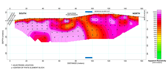
Geoelectrical investigation methods - Resistivity measurements are made by passing an electrical current into the ground through one pair of electrodes that are nailed to the ground. Current flow between these electrodes fans out through the ground in a pattern and intensity that depends on the conductivity of the ground and any stratification or obstacles that lie in the vicinity of the electrodes. Increasing the distance between electrodes increases and the penetration depth, revealing more and deeper information.
ELECTRICAL RESISTIVITY TOMOGRAPHY (ERT)
Shallow geology exploration & mapping Upper bedrock surface depth profiling, Soil/Sediment stratigraphy profiling, Sand/Gravel exploration & mapping, Fault detection & mapping, Groundwater exploration & mapping, Oil Sands exploration & mapping, Shallow Gas exploration & mapping.
